The Coastal Zone Management Unit (CZMU) is gearing up to undertake a number of projects aimed at strengthening the coastal infrastructure in selected areas.
These projects are being undertaken under the IDB/Government of Barbados-funded Coastal Risk Assessment and Management Programme being executed by the CZMU.
Deputy Director of the CZMU, Antonio Rowe, highlighted the work to be done on the projects on the sidelines of a recent workshop at the Lloyd Erskine Sandiford Centre.
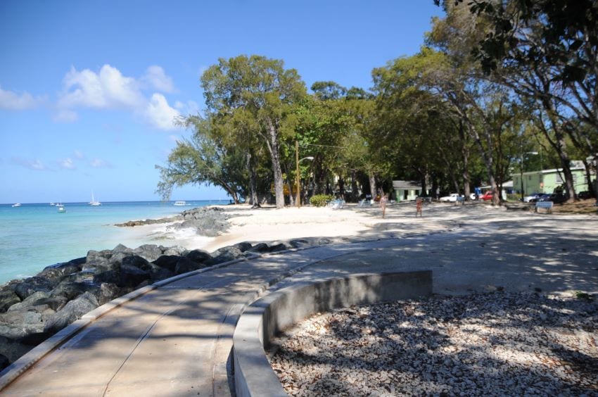
Noting that coastal engineering work executed at Welches, Christ Church, to mitigate the impact of the sea water washing into the road during various weather events, and the Holetown Waterfront Improvement project were a success, the Deputy Director said an additional four projects were presently at the design phase.
One project will run from Clinketts in St. Lucy, where the coastal road is exposed to elements such as overtopping (sea water going into the road) at Sand Street, by the old Speightstown Road, and on the west coast in the area between St. Peter’s Bay and Mullins Beach.
“The beaches at Clinketts and at Sand Street are relatively narrow. Sometimes, during above normal swells, you would find sand in the road and get some overtopping by the sea.
“In addition, the elevation of the roads in relation to the beach, especially in Clinketts, the road and the beach are almost at the same level, and there are also some drainage issues up there. So, what we were really trying to do is protect the coastal road,” Mr. Rowe explained.
Work done in this area would involve looking at the oceanographic conditions, and observing and analyzing the trends to determine what structures would work best in the area.
He added that the Mullins to St. Peter’s Bay, St. Peter stretch was about 1.6 kilometres and showed signs of heavy erosion over the years.
“That is going to be a bit challenging in terms of what we do there because there is an offshore reef in the area. So, the design has to take into account the existing conditions and what is there and what is offshore…. The design process for that has started and we actually had to undertake some physical modelling in Canada, where we actually built part of those structures in a lab and run the different conditions….,” Mr. Rowe pointed out.
Meanwhile, on the south coast, Mr. Rowe said attention will be given to the area of Oistins Bay behind the Berinda Cox Fish Market, where there are drainage issues. “We will be looking to see if we could make the area better and see what other improvements can be made,” he said.
He noted that the concepts for improvement included possible beach expansion and proper access that would take persons from the Bay Gardens straight over to Miami Beach, Christ Church.
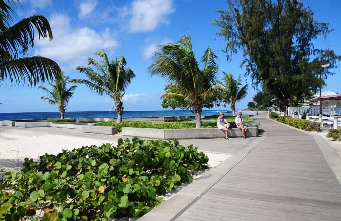
He said there was also a proposal for the extension of the Richard Haynes Boardwalk from Accra Beach to St. Lawrence Gap.
“We have quite a bit of infrastructural work in the pipeline to make our coastline more resilient to climate change adaptation and disaster risk management. That is what we do best,” Mr. Rowe stated.
He added that the interesting part of the project would come when the designs were completed and they were placed in a computer model to see the reduction of costs and damage.