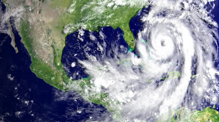
As officials continue to monitor Tropical Storm Tammy, sea bathers and mariners are being urged to stay away from the sea as marine conditions continue to deteriorate with the approach of the system. There is also a small craft warning and high surf advisory in effect for the marine area.
As the system becomes more defined as it continues its track towards the island chain and Barbados, and as Barbados remains under Tropical Storm Watch, members of the public are advised to continue monitoring the system’s approach.
Persons are urged to commence their preparations from now. Individuals, businesses and other stakeholders should activate their emergency contingency plans, as this Tropical Watch could be increased to a Tropical Storm Warning at short notice.
However, and notwithstanding that fact, we are expecting possible intense rainfall, high winds (with gusts possibly up to storm force strength) as the feeder bands of the system passes through.
Actions should therefore include securing properties, storing water, and having the usual hurricane supplies ready to hand. Families should also have an early exit plan if they believe their homes are likely to be compromised, and know those Emergency Shelters closest to them.
“This is not the time to be complacent! We saw earlier this month the effects of feeder bands from Tropical Storm Phillippe, so with this fresh in our minds, we at the DEM implore each and every one of you not to take any chances. If the system passes us without significant or minimal impact, we would have been able to test our systems and identified any areas for improvement. But, if it impacts us, we will be ready to ride it out safely and effectively respond,” said Deputy Director of DEM Captain Robert Harewood.
At 2:00 p.m., the centre of Tropical Storm Tammy was located near 13.5 north, 56.4 west or approximately 210 miles East of Barbados, with maximum sustained winds of nearly 60 miles per hour. The system has slowed down and is now moving westward at 14 miles per hour.
The latest statement from the MET Office warns that marine conditions are forecast to deteriorate from tonight, Thursday, October 19, with moderate to rough swells of eight to 11 feet in open water.
On its present track, Tropical Storm Tammy is forecast to pass approximately 120 miles north of the island on Friday afternoon.
The statement warned that any southward deviation to the projected track may result in the watch being upgraded to a warning on short notice.
The system is projected to bring shower activity from tonight, Thursday, October 19. That activity is expected to intensify from tomorrow afternoon, Friday, October 20 into Saturday morning. Members of the public are again encouraged to continue monitoring the Barbados Meteorological Services, the Department of Emergency Management and the Barbados Government Information Service’s social media pages and websites for updates.
